
Mike's E Bikes
Region: Canada’s Musical Coast
Community: Port Hood
Mike’s E Bikes offers rentals of 26” electric mountain bikes, in the heart of Canada’s Musical Coast, in beautiful Port Hood, Cape Bre...

Hiking Time – 25 minutes
Difficulty – 2
Trailhead GPS Reference – 45°51’54.2″N 61°16’17.5″W
Trail Access: Turn off of the Trans Canada Highway on to River Denys Rd. Follow the road for about 1 km and you will see flagging tape that indicates the trailhead. Myles Doyle Falls are located at the end of a short hike just below this point. Because of the easy nature of this trail you can take your family and have a picnic by the falls.
Region: Canada’s Musical Coast
Community: Port Hood
Mike’s E Bikes offers rentals of 26” electric mountain bikes, in the heart of Canada’s Musical Coast, in beautiful Port Hood, Cape Bre...

Region: Canada’s Musical Coast
Community: Mabou
The Bellemeade Farm Shoppe is located in Mabou, Nova Scotia, on the rugged west coast of Cape Breton Island. Our flock of sheep is shorn onc...

Region: Canada’s Musical Coast
Community: Mabou
An Drochaid (The Bridge) Museum is located in Mabou (60 km / 37 mi from the Canso Causeway) on Cape Breton Island. Formerly a general store ...
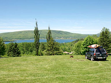
Whycocomagh Provincial Park occupies a dramatic hillside overlooking the Skye River Valley and the Bras d’Or Lakes. This is a quiet scenic...
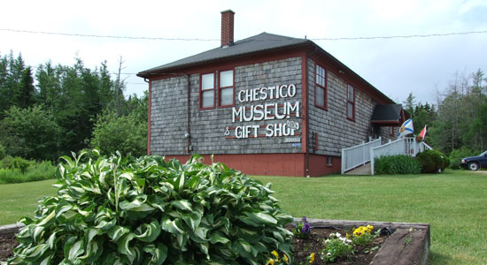
Region: Canada’s Musical Coast
Community: Port Hood
The Chestico Museum has operated as a community museum since 1986. Highlighting the history and heritage of the Port Hood area, its mission ...

Region: Canada’s Musical Coast
Community: Mabou
A religious shrine enclosed in a miniature pioneer church, dedicated to Our Lady of Seven Sorrows and the pioneers of the Mabou area. ...
June on Cape Breton Island is when music fills the air, feet find rhythm on wooden floors, and communities come together in celebration of culture, heritage, and shared joy.
Snowmobiling offers exhilarating experiences across winter landscapes, but safety must always be a priority.
Atlantic lobster from Cape Breton Island is renowned for being the freshest and some of the tastiest lobster in the world.
Tap your toes to fiddle tunes at a Ceilidh. See authentic Acadian crafts at Les Trois Pignons. Take a piece of Mi’kmaq culture home with you at a drum-making workshop. On Cape Breton Island, culture is all around you just waiting to be explored!
When the adventurous duo Chris and Jan from A for Adventure received the call to explore Cape Breton Island’s magical Waterfall Season, they packed their gear, laced up their boots and set their sights on some of Nova Scotia’s most breathtaking scen
Cape Breton Island Ambassadors Davey and Sky were selected by Explore Canada as official ambassadors for their home province of Nova Scotia.
Cape Breton Island Ambassador Ashley George was selected by Explore Canada as an official ambassador for her home province of Nova Scotia.
When Cape Breton Island dons its blanket of snow, it transforms into a winter wonderland bursting with adventure and serene beauty.
Cape Breton Island is renowned for its breathtaking landscapes, and when winter descends, the island transforms into a wonderland of snow-covered trails, frosted trees, and serene vistas.


