
The Annex Inverness
Region: Canada’s Musical Coast
Community: Inverness
The Annex is a new bar & restaurant located in the seaside town Inverness, NS. Highlighting in-season, local ingredients and products on...

Length: 30+km (18.8+mi) total
Hiking time: 1-8+hr
Type of Trail: natural surface, compacted earth
Uses (no snow): walking
Uses (snow): snowshoeing
Facilities: interpretive panels
Dog Use: off-leash permitted
Gov’t Topo Map: 11K03 (Lake Ainslie)
Rating (1-5): 4 [steepness]
Trailhead GPS Reference: N 46 08” 31.6’ W 61 26” 48.2’
Access Information: In the village of Mabou, turn off Highway 19 onto the Mabou Harbour Road. Drive 5 km (3 mi), turning right onto the unpaved Mabou Mines Road. Continue 7 km (4.5 mi) to the bridge at Mill Brook, just past the last house and clearing. Either park here, or continue about 500m/yd on the other side up the deeply rutted small hill and park at the Mabou Post Road Trailhead sign, without blocking the road.
Introduction: The Mabou Highlands form a rounded knoll 15 km (9.5 mi) long by 8 km (5 mi) wide reaching an elevation of 335 m (1100 ft) at the north end and 320 m (1050 ft) at the south. Formed of highly erosion-resistant, metamorphosed sedimentary and volcanic rocks, the surface is highly dissected and the sides deeply eroded. Many trails in the Mabou Highlands are quite challenging, requiring strenuous climbs to reach the best viewing sites.
These same Mabou Highlands were also once the home of many industrious Scottish families, who cleared the hills and grazed sheep on their grassy slopes. Now, save for a few cottages, the area lies mostly deserted and forest has reclaimed the ravines. The former cart tracks connecting long abandoned farms have become a network of challenging trails, courtesy of the volunteer Cape Mabou Trail Club. By 1998, twelve different trails totalling more than 30 km (18.75 mi) of maintained paths were available.
Cautionary Notes: Wildlife. Hunting permitted. Steep climbs. Motorized vehicles in some sections. Poison Ivy. Cell Phone reception is generally available at higher elevations. No reception ravines, under thick foliage, and on most inland sections.
Ratings are designated from 1 to 5 indicating suitability for all fitness and experience levels, with 5 being suitable only for experienced and very fit outdoor people. Novices should only choose level 1 and 2 hikes, and work their way up. Level 4 and 5 hikes have indicators associated with their ratings.
Region: Canada’s Musical Coast
Community: Inverness
The Annex is a new bar & restaurant located in the seaside town Inverness, NS. Highlighting in-season, local ingredients and products on...

Region: Canada’s Musical Coast
Community: Mabou
Nestled in the rolling hills of Inverness County on beautiful Cape Breton, this world-class professional theatre has played host to internat...
Region: Canada’s Musical Coast
Community: Inverness
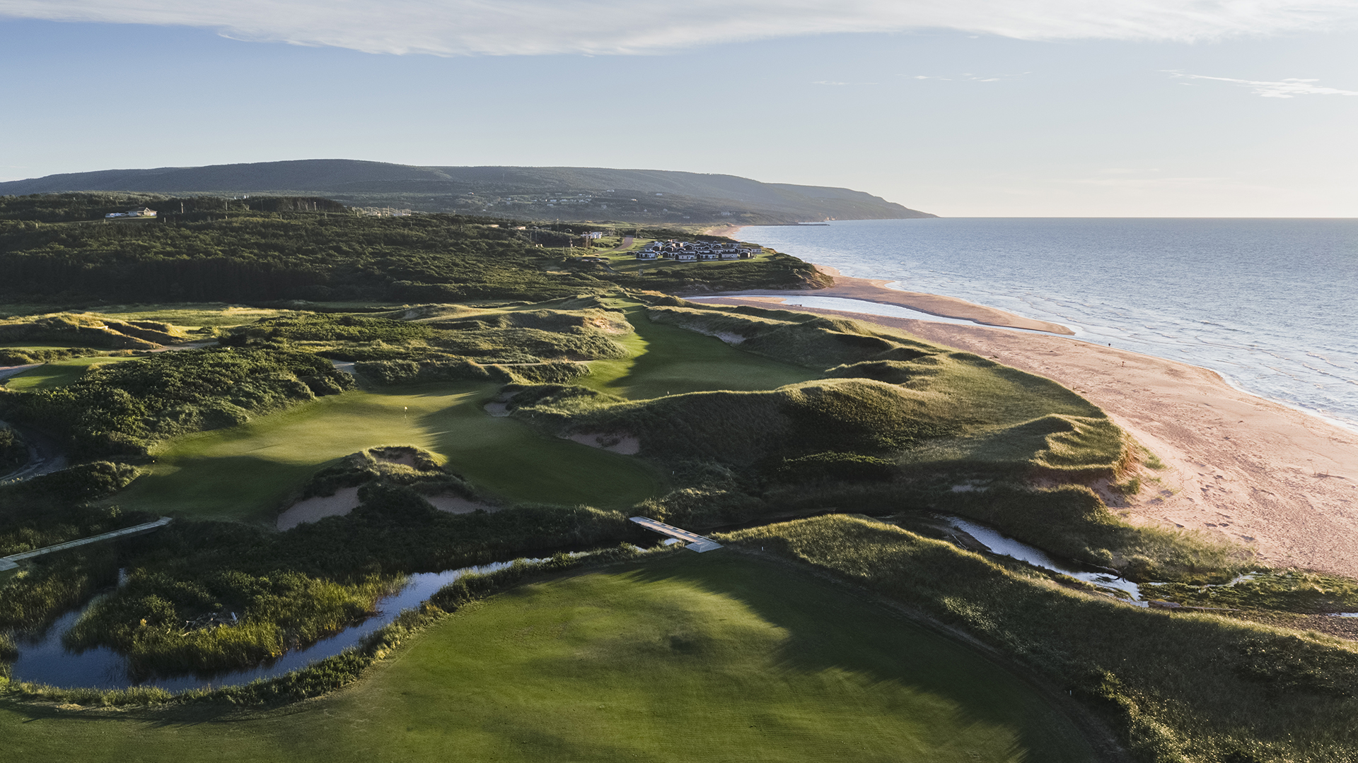
Exquisitely carved out of the breathtaking Cape Breton landscape, with postcard worthy panoramas vying for your attention and rich, rolling ...

Region: Canada’s Musical Coast
Community: Port Hood
Mike’s E Bikes offers rentals of 26” electric mountain bikes, in the heart of Canada’s Musical Coast, in beautiful Port Hood, Cape Bre...

Region: Canada’s Musical Coast
Community: Inverness
Located in the brand new Company House building, as soon as you enter Inverness. An ideal spot to grab a deli sandwich, cup of coffee, fresh...

Region: Canada’s Musical Coast
Community: Inverness
Nature paintings, fairy village and fairy crafts. Free little library and TARDIS on-site. ...
Looking to learn more about your family roots? Check out 10 of our cultural experiences that are available to you this summer!
There are so many hiking trails with phenomenal views in Cape Breton that it’s difficult to narrow it down to 5.
Looking to visit some super epic waterfalls this summer as part of your escape to Cape Breton? Well we’ve got just the five for you to explore.
While chasing waterfalls is good for the body, mind and spirit there are a few things you should remember before hitting the trails to ensure you have a great time and make it back home safely!
Get ready, curling enthusiasts and sports fans alike! This month, the World Women's Curling Championships are hitting the ice in Sydney, Cape Breton Island.
While there are countless places on Cape Breton Island to get away from it all, Sydney and area offers a different experience—urban amenities and downtown vibes with a waterfront feel.
No matter the time of year, for my wife and I, the weekend means heading to the Cabot Trail for an adventure.
Don't put that camera away just because it's cold! Winter on Cape Breton Island is an Instagrammer's wonderland.


